
DOWNLOAD THE APP


Customer Services
Copyright © 2025 Desertcart Holdings Limited
DOWNLOAD THE APP
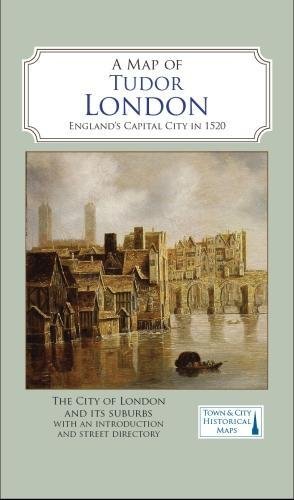
Full description not available
A**E
Excellent Map
An excellent map. It creates an informative image of London in 1520 and where places and buildings are in relation to each other. A very useful grid reference is provided on the opposite side as well as a brief outline of London at this time. You can see how London was expanding beyond the old City Wall and how newer boundaries were being drawn up. A great complement to other maps - Londinium and (hopefully the forthcoming map - Medieval London. A recommended source for anyone interested in the history of London.
O**K
Wonderful map
Bought this for my wife's birthday as she is historical novel writer. She loved it and posted about it on facebook. One of her friends read about it and bought one for herself!
F**S
Tudor London
Lovely detailed map just didn't quite cover the part of London I wanted. Would like to have seen the old City square mile detailed.
F**A
Hours of pleasure
Wonderful for the time travelling Londoner or tourist. Hours of pleasure. Great value too.
M**D
Tudor City of London made clear
This is an excellent publication. The map and the information on the map is clear and easy on the eye. The index is very easy to use and the additional explanatory notes are very useful. Fully recommend.
R**.
Worth a look
Great historical map printed in modern style
K**L
Compare with the current road network
Detailed map. Very interesting to compare the Tudor roads with today's road structure.
A**R
Very little South of the Thames
Very clear map of London north of the Thames. I was hoping for more of Southwark. Was going to return it especially as I paid £10.99for it. But they want to deduct £2.25 for postage. Not worth returning it. Very disappointed 😢
A**R
Beautiful huge pristine map, sturdily packaged
I ordered this map for a writing project. It is better than expected. The paper is heavy and sturdy and will withstand much use. The detail is minute and yet crisply printed and legible. There is an impressive directory of sites on the back with additional detail about architecture and history squeezed in. Yet, with all this detail there is no sense of clutter. The layout is aesthetically pleasing and the color pallette easy on the eyes: pale green, tan, yellow with peach accents and maroon lines. I believe anyone who is fascinated with Tudor England would find the map highly accessible. At the same time, it seems to me as a non-expert in the field that the map was created with sufficient precise detail and attention to historical context to satisfy the most knowledgeable and discerning expert. I commend Books Etc. Ltd for the sturdy cardboard packing which protected the contents very well.
S**N
So interesting, so much detail!
This map shows what I was looking for - the sixteenth-century wards of London - but it also includes so much more information that I was not expecting. The London Topographical Society are the leaders in this field - scholarly but with a wide appeal. Much appreciated! I love my A to Z of Elizabethan London as well!
K**N
An Aid to Time Travel
I write Tudor-era historical fiction, and this is the next best thing to being there. The map has more information on it than I would have thought possible - pub names and market areas and royal properties, among many others. I could easily plan my characters' travel through the city and understand what they would see.
W**R
Fabulous trip through history
Saw this map on a YouTube video was thrilled to find it here. Now looking for the Medieval map of London by the same publishers but Amazon doesn’t seem to carry it now.
A**R
Uninspired. Very pale lettering. Difficult to read red lettering on darker pink buildings.
Very pale lettering. Difficult to read red lettering on darker pink buildings. Size is large and that is helpful, although I would have preferred important detail on the outer wall to be side inserts and make the city within the wall larger.
Trustpilot
2 days ago
1 month ago
1 week ago
2 weeks ago